Collection methods
How we obtain various types of traffic data
(Centerline) Miles and Lane Mileage
One mile of a single roadway, regardless of the number of lanes, is called a centerline mile. While the centerline mileage does not account for the number of lanes, lane mileage does. Lane mileage can be found by multiplying the continual driving lanes and centerline mileage. Temporary lanes like turn lanes are not counted nor are lanes on ramps or in auxiliary areas such as rest areas.
Records are extracted from the LRS to produce Miles and Lane Mileage reports. To provide consistent figures, reports are run against an HPMS snapshot of the database taken every December. This snapshot is used for reports until a new snapshot is taken. The following are criteria for LRS record selection:
- Geographic Area (statewide; by county, municipality, MnDOT Construction District, or Area Transportation Partnership)
- Route Type (ie. Highways or Local Roads)
- Other criteria as needed (roadway surface types, functional classes, etc.)
If lane mileage is requested for a report, the number of continual driving lanes are extracted and calculated according to the individual data item values in each of the combinations of groupings. Then, those values are multiplied by the centerline mileage figures.
Vehicle Miles Traveled (VMT)
Vehicle Miles Traveled (VMT) is calculated by multiplying annual average daily traffic (AADT) by the centerline mileages of each roadway segment under consideration. Heavy commercial VMT (HCVMT) can also be calculated by using estimates of commercial truck volumes. HCVMT is only produced for Minnesota's trunk highway system, so historical trends for heavy commercials are only available on Interstate, U.S., and State Highways. VMT figures are used by MnDOT to measure the demand on the transportation network. When VMT and centerline mileage statistics are grouped to form a report, up to three inter-related groupings can be specified. Also, individual values can be grouped to provide combined values, such as combining values for all trunk highways. To provide consistent figures, VMT reports are run against a "snapshot" of the database taken every December. The statistics remain constant until a new snapshot is taken. View the most recent VMT reports.
Trunk Highway Keypoints, and Reference Post Listing
The Trunk Highway Keypoint report lists landmarks that intersect the various Interstate, U.S. Highway, and Minnesota State Highway routes, in sequential order based on their cartographic (carto) mileage, a 2-dimensional distance from the beginning of the route (ignoring change in length due to elevation). Landmarks include features such as roadways, bridges, rail grade crossings, municipal and county boundaries. The listings include such descriptive columns as:
- City/Twp Indicator - C = City, T = Township, U = Unorganized Territory
- City/Twp Name – Name of the city or township
- City/Twp GNIS – Official Geographic Names Information System ID for the city/township
- City/Twp FIPS - Federal Information Processing Series, a unique five-character identifier for each city/township/unorganized territory
- Construction District Code - Code representing the MnDOT District Office with jurisdiction over the route
- Control Section - 4-digit code representing a state highway road system segment, divided into shorter, more manageable parts for record keeping. The first two digits equals the county code
- County - 2 digit county code where the route keypoint is located
- Features– Description of intersecting feature(s)
- Measure – Cartographic Measure distance in miles from start of the feature along the route
- Patrol Station – State Patrol District Station number with jurisdiction over the route
- Reference Point – Location of the feature along the route, expressed as miles from the last passed reference post
- Remark - Additional route information: co = start of coincident route, en = end of route, gp = start of gap in route
- Route – Common name for the route
- Winter Maintenance Subdistrict ID – MnDOT Maintenance Subdistrict which maintains the route in the winter
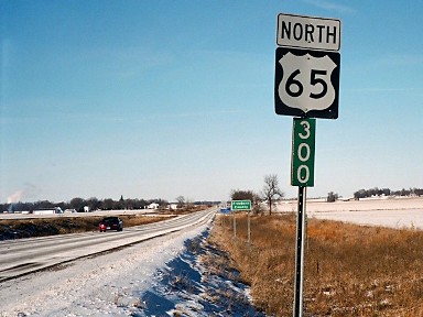
In addition to centerline carto mileage, the Keypoint report includes a second type of measure called reference points. Reference points are based on reference posts (also called “mile posts”) which are numbered signs physically located on the side of the road at approximately one mile intervals. Each reference post is, in turn, related to a route carto measure. The relationships and translations between these measures are computer calculated. Reference points are used to provide a type of locational stability. Route carto mileage is like an odometer mileage along a route, which starts at zero for each individual route, usually at the south or west end of the route. Carto mileages along a route may change over time (due to realignments, for example) while events tied to a reference post/point remain fixed. The statewide Reference Post report also uses the HPMS snapshot data and contains information on the centerline mileage for each reference post along Minnesota's trunk highways.
Keypoints by County, and Keypoints by County Details
The Keypoints by County and Keypoints by County Details reports lists landmarks that intersect the various routes of all levels in the LRS, in sequential order based on their cartographic (carto) mileage, a 2-dimensional distance from the beginning of the route (ignoring change in length due to elevation), for each county. Landmarks include features such as roadways, bridges, rail grade crossings, municipal and county boundaries. The listings include such descriptive columns as (K = both Keypoints Reports, D = Keypoints by County Details Report and C = Keypoints by County):
- Access ControlC - through traffic design of the road segment. Full =Full Access Control, Part =Partial Access Control, No = No Access
- Additional Lane Width and TypeD - Number and type of additional lanes on the right (R) and left (L) side of the road
- Basic PavementD – Pavement surface or route
- City/Twp IndicatorK- C = City, T = Township, U = Unorganized Territory
- City/Twp NameK – Name of the city or township
- City/Twp GNISK – Official Geographic Names Information System ID for the city/township
- City/Twp FIPSK - Federal Information Processing Series, a unique five-character identifier for each city/township/unorganized territory
- Construction District CodeC - Code representing the MnDOT District Office with jurisdiction over the route
- Control SectionC - 4-digit code representing a state highway road system segment, divided into shorter, more manageable parts for record keeping. The first two digits equals the county code
- CountyK – 2 digit county code where the route is
- CurbD - Side of curb (R=Right, L = Left and B = Both) and type (Barrier and Mountable)
- Facility TypeC - Operational characteristic classification of a route segment. 1-way, 2-way, Ramp, Non Main = Non-mainline, Non Inv = Non-inventory direction, Planned = Planned/Unbuilt
- FeaturesK – Description of intersecting feature
- Functional ClassC - defines the character of service a road is attended to provide. For example, Prin. Art. = Principal Arterial
- MeasureK – Carto Measure distance from start of the feature along the route
- MedianD – Width and type of Median
- Number of LanesC - Total Number of through lanes on specified route and side (increasing or decreasing)
- Parking Lane Width and TypeD - Width and type of parking lanes on the right (R) and left (L) side of the road
- Patrol StationC – State Patrol District Station number with jurisdiction over the route
- Paved Shoulder Width & TypeD – Width of paved shoulders on the right (R) and left (L) side of the road
- Reference PointK – Location of the feature along the route, expressed as miles from the last passed reference post
- RemarkK - Additional route information: co = start of coincident route, en = end of route, gp = start of gap in route
- RouteK – Common name for the route
- Statutory RouteD - Constitutional or Legislative route number(s)
- Turn Lane Width & TypeD - Number and type of turn lanes on the right (R) and left (L) side of the road
- Unpaved Shoulder Width & TypeD – Width of unpaved shoulders on the right (R) and left (L) side of the road
- Urban CodeC - Urban or Rural status. 99999 = Rural (population < 5000), 99998 = Small Urban (population >= 5000 and < 50,000), Other = Large Urban (population >= 5000)
- Winter Maintenance Subdistrict IDC – MnDOT Maintenance Subdistrict which maintains the route in the winter
In addition to centerline carto mileage, the Keypoint report includes a second type of measure called reference points. Reference points are based on reference posts (also called “mile posts”) which are numbered signs physically located on the side of the highways at approximately one mile intervals. For local roads we have theoretical reference posts that are exactly 1 mile apart but exist only in the database, not in the field. Each reference post is, in turn, related to a route carto measure. The relationships and translations between these measures are computer calculated. Reference points are used to provide a type of locational stability for trunk highways. Route carto mileage is like an odometer mileage along a route, which starts at zero for each individual route, usually at the south or west end of the route. Carto mileages along a route may change over time (due to realignments, for example) while events tied to a physical reference post/point remain fixed. The statewide Reference Post report also uses the HPMS snapshot data and contains information on the centerline mileage for each reference post along Minnesota's trunk highways.
Construction Project Log
MnDOT's Construction Project Log is a quick visual history of trunk highway road construction and maintenance over time-- the “what, when, and where” guide to field work that has been done since the original construction of the road. Each Project Log has start and end limits illustrated by a straight line map located at the top of the page. The individual project limits themselves are described by horizontal lines located within some portion of that map. Each project is dated along the left side of the page along with a brief description of the work involved, the SP number, year of construction, width and depth of surfacing, material type, etc. Project logs are organized by county and by district, and then by control section.
Since it normally includes only mainline work, information on ramps, roadside work, turn lanes, temporary and bypass construction, median barriers and bridge maintenance work is not included. Also, the project log is not intended to be a source of information for bridge details. Bridge construction and replacements are usually included in or tied to mainline grading and surfacing projects. Finally, not all highways sections have project logs. If the road was initially constructed by a different road authority and then handed over to MnDOT afterwards, a log is generally not available. If a roadway section was originally built by MnDOT, a project log should be available.
We are considering improvements for our Construction Project Log page. Help us improve our Construction Project Log by taking our survey.
Functional Classification
Functional classification is the grouping of streets and highways into classes or systems according to the character of service they are intended to provide. When classification changes are made, the roadways are reviewed for possible State Aid system inclusion. When changes occur, roadway revisions and the basemap line work and online maps are updated to portray the physical change to the facility. MnDOT's Functional Classification page provides a comprehensive look at the change process, FHWA requirements and guidelines, maps and other resources.
Control Sections and Statutory (Constitutional/Legislative) Routes
State highways are divided into segments called Control Sections. The purpose of these sections is to enable more stable record keeping. When highways are moved/reassigned, the Control Section and any related data stayed tied to the pavement and not to the route. This enables better management of the highway, including maintenance, construction, and administrative purposes.
A control section is identified as a four-digit number. The first two digits identify a sequential county code and the last two digits are an identifying number within that county. Control Sections have a defined begin and end location called termini. Termini typically will be a county boundary or an intersection of another highway. Control sections can change and are revised when a highway is realigned, a new state highway is built, or due to a transfer of ownership of the route (typically from the state to a county).
Statutory routes are defined by the Minnesota State Legislature and are what authorizes MnDOT to build highways. They are composed of constitutional and legislative routes. Routes numbered 1 to 70 are referred to as Constitutional Routes, defined as part of the Babcock Amendment to the Minnesota State Constitution in 1920, and cannot be altered or removed without a change to the State Constitution. Routes numbered greater than 70 are referred to as Legislative Routes, which can be added or removed by the legislature. It is important to note that the number of a statutory route is not necessarily the same number of the highway as you might see it on a sign. These routes can be assigned to one or several highways, and their purpose is to ensure “connectivity” between communities.