Background

The Historic Roadside Property and Waysides Program began in the late 1990s. As road projects were developed, these historic waysides were discovered and required significant research in order to understand their significance. In 1996, MnDOT decided to undertake a statewide survey to locate and do preliminary evaluations of these properties to streamline the review process for individual projects. What they found was that Minnesota had a unique and extensive collection of waysides developed during the early decades of highway development. Between July 1996 and December 1998, MnDOT inventoriedy 102 of its wayside rests built before 1961on Minnesota trunk highways. The report, Historic Roadside Development Structures on Minnesota Trunk Highways, was published and distributed in September 2000; a supplement that added eight new properties and updates was completed in 2005.Of the original 110, 58 were found Listed on or eligible for the national register. This list included several bridges and walls not included in future studies.
As the 50 year window for potential eligibility for the National Register moves, new studies have been completed to include rest areas and waysides built up to 1975.
The MnDOT Cultural Resources Unit completed a study defining the historic context for historic properties in the 1955-1975 era. This study was completed in 2016.
In 2020 the CRU completed the most recent study to streamline all the previous reports and studies into one document. Minnesota Trunk Highways Roadside Properties, 1932-1975: A Cumulative Study. This study was also the first to evaluate rest areas of all sizes and types and on interstates if constructed prior to 1975.
All of these reports can be found on our Publications webpage. Some have been incorporated into the MnDOT Digital Library.
Original historic plans
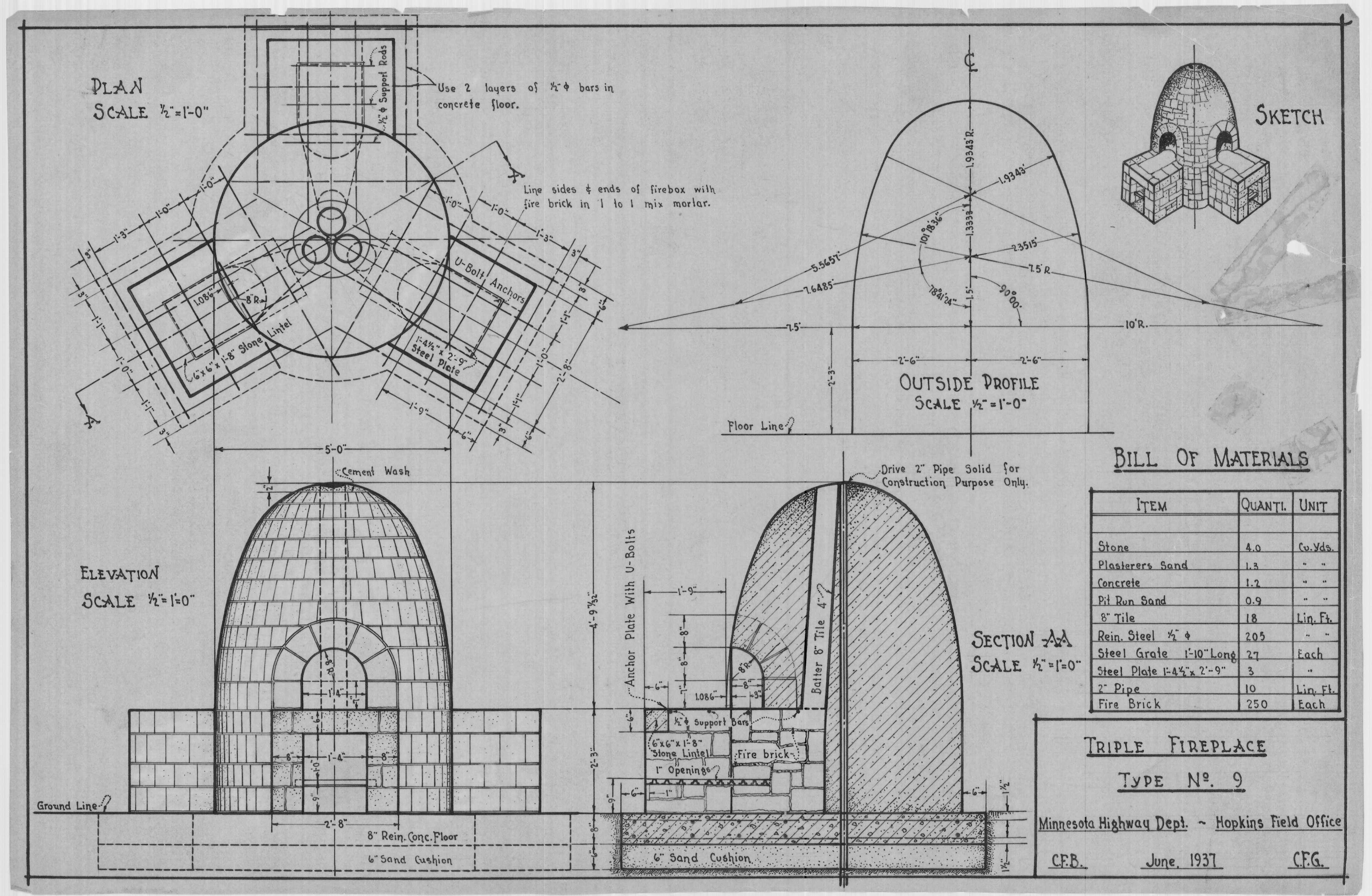
The Historic Roadside Property and Waysides program holds scans of original drawings from the 1930s and 40s, which include beautiful hand drawn plans and details. Many of these are included in wayside evaluations, but some are unidentified, and others are for sites that have been razed or are no longer owned by MnDOT. We will add these to the digital library in the future. Some waysides were razed or transferred to other agencies before the 1998 study and have not been evaluated. We haven’t found all of them yet!
Setting priorities
The Historic Roadside Property and Waysides program undertakes several rehabilitation and preservation projects each year. Projects are identified using defined selection criteria and ranked each year
The details of this process are available on the Project Selection Page.
Which properties are “Historic”?
Over 250 roadside properties, waysides, and rest areas have been evaluated for historic significance. Of those, only a small number are truly considered “historic.”
Historic is defined as eligible for or listed on the National Register of Historic Places.
The list of “historic” properties also changes frequently. Sites are sometimes transferred or are changed with changing transportation needs. The Historic Roadside Property Program Manager maintains the information on all properties evaluated as roadside property. The following tables list properties which are “historic” and their status; listed, eligible, and in a Historic District.
National Register Listed Roadside Properties
| Name | SHPO number | County | Road |
|---|---|---|---|
| Cascade River Wayside | CK-UOG-044 | Cook | MN 61 |
| Craigie Flour Mill Historic Marker | OT-OTT-001 | Otter Tail | MN 78 |
| Garrison Concourse | CW-GRC-001 | Crow Wing | US 169 |
| Graceville Historic Marker | BS-GRA-017 | Big Stone | MN 28 |
| Inspiration Point Wayside Rest | FL-CRL-011 | Fillmore | MN 16 |
| Kenney Lake Overlook | CW-GRT-003 | Crow Wing | MN 18 |
| Lake St. Croix / Stillwater South Overlook | WA-OHC-005 | Washington | MN 95 |
| Orr Roadside Parking Area | SL-ORC-005 | Saint Louis | US53 |
| Pine-Hickory Lakes Roadside Parking Area | AK-FIS-017 | Aitkin | US 169 |
| Preston Overlook | FL-PRC-041 | Fillmore | US 52 |
| Reads Landing Overlook | WB-PEP-012 | Wabasha | US 61 |
| Redwood Falls Retaining Wall | RW-RFC-032 | Redwood | MN 19/US 71 |
National Register Historic District Properties
| Name | SHPO number | County | Road |
|---|---|---|---|
| Gooseberry Falls Concours- contributing | LA-SVC-046 | Lake | MN 61 |
| Marine on St. Croix Roadside Parking Area | WA-MXC-015 | Washington | MN 95 |
| Mantorville Retaining Walls-non contributing | DO-MTC-038 | N/A | N/A |
TH 301 Retaining Walls - non contributing |
N/A |
Sherburne |
MN 301 |
| Vineland Historic Marker-not contributing | ML-KAN-006 | Mille Lacs | US 169 |
National Register Eligible properties
| Name | SHPO number | County | Road |
|---|---|---|---|
| Baudette Rest Area | LW-BDC-030 | Lake of the Woods | MN 72 |
| Burgen Lake Rest Area | DL-HUD-010 | Douglas | I 94 |
| Graeser Roadside Parking Area | HE-RBC-025 | Hennepin | TH 100 |
| Lake City Concourse | WB-LKC-093 | Wabasha | US 61 |
| New Ulm Spring Roadside Parking Area | NL-CTT-006 | Nicollet | TH 14 |
| Oak Lake Rest Area | PL-KNU-001 | Polk | US 2 |
| Ottertail Lake Rest Area | OT-OTT-003 | Otter Tail | MN 78 |
| Sibley Pioneer Church (monument only) | DK-MDC-011 | Dakota | MN 13 |
| Split Rock Lighthouse Overlook | LA-BBT-023 | Lake | MN61 |
| St. Paul Overlook [Burns Ave] | RA-SPC-2927 | Ramsey | US 61 |
